Putting the Map in Perspective:
Drawing Territory and Landscape in Geography
In the collaborative Drawing Workshop between the Faculty of Fine Arts of the University of Porto/Research Institute in Art, Design and Society (FBAUP/i2ADS and the MSc in Geography Teaching in the 3rd cycle of Basic Education and in Secondary Education, Faculty of Arts and Humanities of the University of Porto (FLUP), as part of the research project DRAWinU – Drawing Across University Borders (PTDC/ART-OUT/3560/2021).
The challenge posed to future Geography teachers in Elementary and Secondary Education, currently students at FLUP, was:
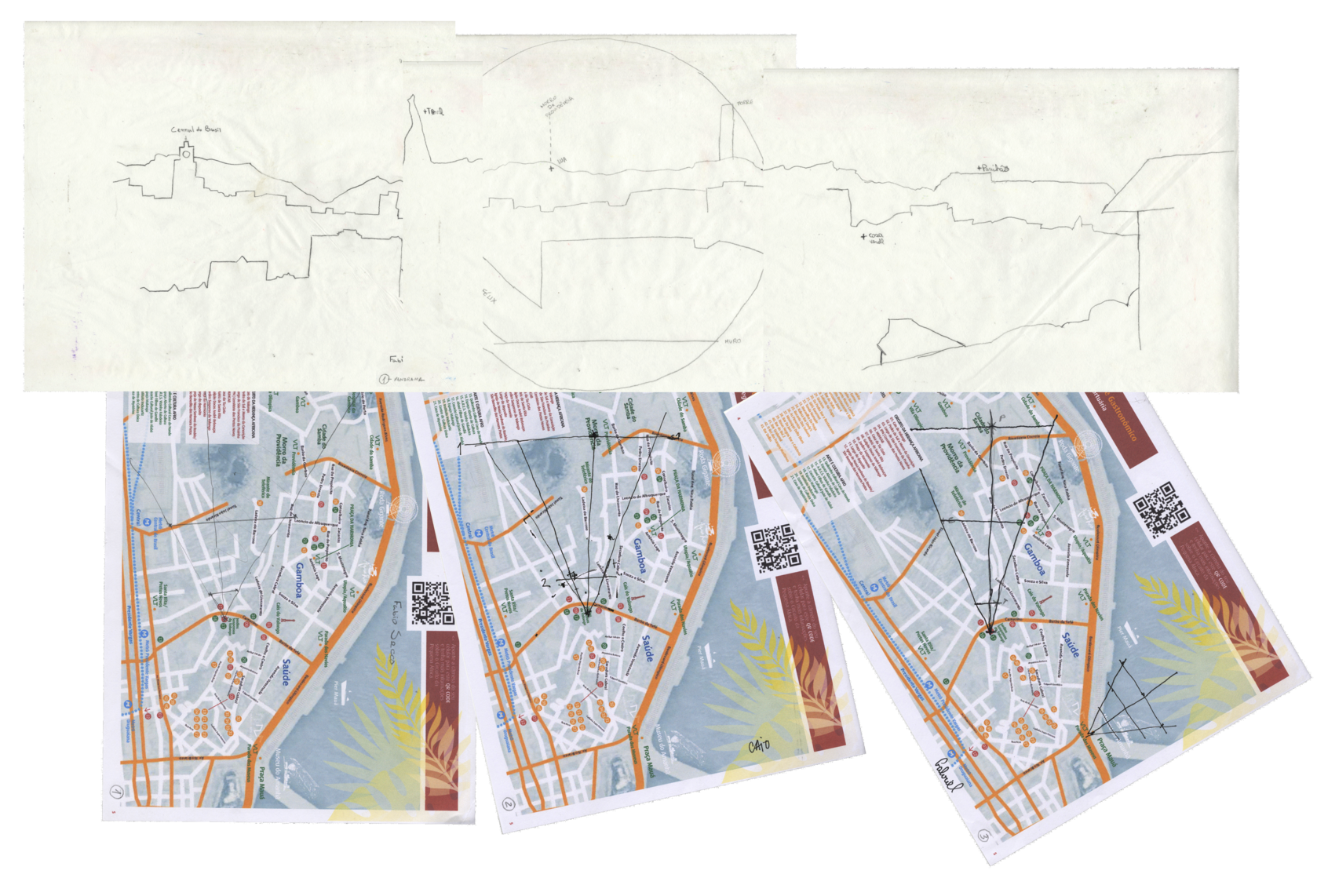
How to reason on landscape starting from its map, while performing hand-drawing on-site sketching?
Drawing strategies and modes used in Cartography – both base and thematic – formed a set of resources provided in the workshop: triangulation, measurement, profile, scale, transparency, legend, and annotation. The challenge was to produce landscape drawings as maps are produced.
Another set of resources offered included some drawing tools to support the act: the compass, the camera lucida, and the app installed on the mobile phone. The body on-site marked the haptic determinant, which required recognizing the differences between Perspectiva Naturalis and Perspectiva Artificialis. The field of view, distance to the Picture Plan, framing, and profiles read in the landscape were the footholds for circumscribing the landscape and revealing the observer/draughts person. All are pre-visualized on the map.
Equipped with those resources, participants were able, through the practice of drawing, to recognize its role as a mediator of attention and knowledge builder.
There were 18 participants/students in 3 hours of intense work in Terreiro da Sé, Porto. A pedagogical approach to geography teaching was explored, using drawing as a central tool. The most ambitious goal was achieved: participants found it easy to replicate the activity in the future, not only in a university context but also in Elementary and Secondary Education settings.

